Description
The “4D Browser – Web-based spatial access to media” project, titled “Urban History 4D,” focuses on the innovative integration of spatial and temporal data to explore urban history. This tool is particularly aimed at visualizing historical development and media within a virtual environment.
The 4D Browser project represents a significant advancement in the way historical urban data is interacted with and visualized, making it an excellent tool for researchers, educators, and the general public interested in the historical evolution of urban spaces.
The project »Urban History 4D« focuses on four-dimensional research and communication of urban history. Its aim is to make available a city’s development over time together with related historic sources, especially photographs, through a virtual spatial model.
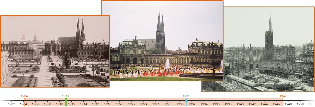
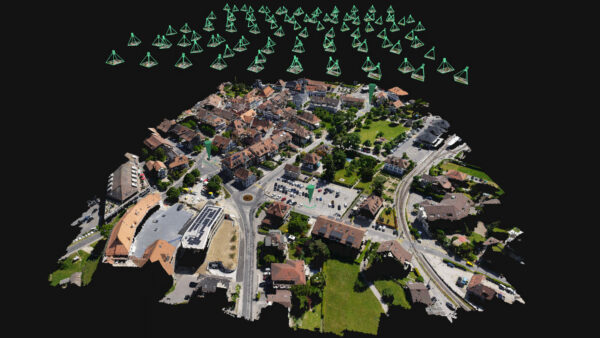
Funded by the Federal Ministry of Education and Research (BMBF), it is a cooperation project between the Technische Universität Dresden and University of Würzburg. The aim is to investigate and develop methods and technologies to transfer extensive repositories of historical media and their contextual information into a three-dimensional spatial model, with an additional temporal component. This will make content accessible to different target groups, researchers and the general public, via a 4D browser. The data resources available for this research include extensive stock of historical photographs of the city of Dresden, which document the city’s architecture since the 1850s, and digitized map collections of the German Photographic Collection (Deutsche Fotothek) platform.
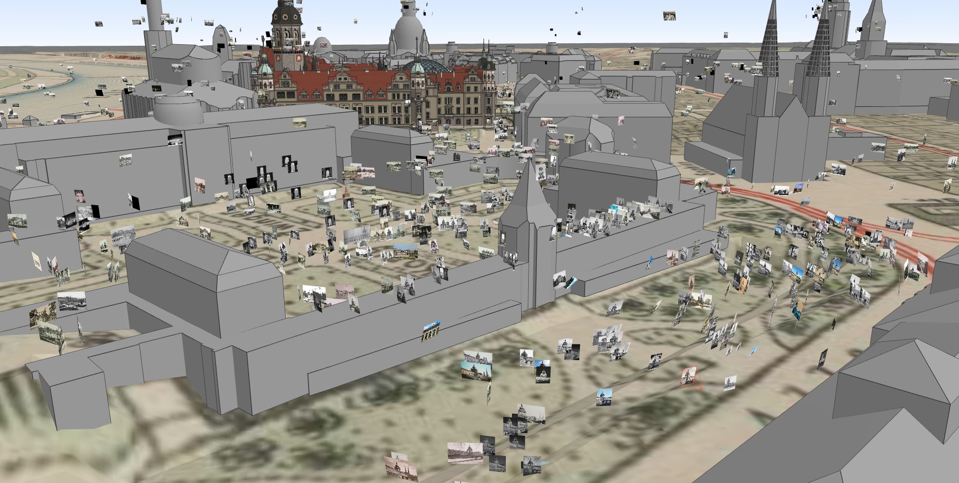
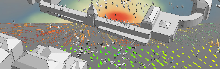
Using digital content und tools provides a valuable support for researchers especially in art history to investigate how the city was photographed over time, taking into account the photographers’ perspectives, positions, and preferred (parts of) buildings. The large number of photographs call for a suitable quantitative examination using scientific visualizations.